Mesão Frio (Mesão Frio)
 |
 |
The occupation of the territory of Mesão Frio dates back to the Romans, who occupied a castro in the area around Cidadelhe (from excavations encountered in this location).
The early nucleus of the modern Mesão Frio was founded near the Church of São Nicolau, which was erected on the instruction of Queen Maud of Savoy, Afonso Henriques' wife.
Mesão Frio was an early shelter on the Roman roadway; it was initially a respect, successively serving travellers, stabling horses and providing fresh animals, the settlement itself evolving approximately in the 3rd century, from the Latin “mansionis frigidae”.
Even before the establishment of a Kingdom of Portugal, the territory was occupied by Subei, Visigoths and Arabs, and for a time were the lands of Penaguião, extending between the Douro and Corgo Rivers, the sierra of Marão and the lands of Panóias (Vila Real). The first medieval references to Mesão Frio appeared in the correspondence of Henrique, Count of Portugal, where it was called “Meijon-Frio”. Its name evolved over centuries with the Portuguese language taking on variations that included: Meijon Frio, Meijó Frio, Mey Johan Frio, Meyon Frio, Meyão Frio and Mezam Frio, until reaching its current variation.
At one time, there was a legend that the toponymy was attributed to Esteves Gracia Monzon Friwn, who in 942 (during the reign of Ramiro II of León) entered along the Douro River with French knights whom took lands and rechristened them. This origin story was supported by the existence of six tombs within the Church of São Nicolau. The funerary monument was sculpted with the coat of arms of French knights, at a time when French knights crossed the territory during the Reconquista (718-1492).
The first foral was allocated by Afonso Henriques in February 1152, and later confirmed by Afonso II on 15 October 1217, while the King was Trancoso. Three days before St. Andrew's Day in 1513, King Manuel I of Portugal renovated the foral (a copy of which is located in the municipal archive).
At one time, this place was the residence for masons who constructed the bridge erected in Barqueiros (by Queen Maud whose husband had left 3000 Maravedi in his testament for the same).
During this medieval period, the settlement was actually divided in two, each with its own master mason, judge and officials (this division actually physically existed until about 1948). Mesão Frio, during the reign of Manuel I, already included the settlements of Cidadelhe and Vila Marim, in addition to the original parishes of São Nicolau and Santa Cristina, as well as a parcel of the Vila Jusã that included the village called Meigõ frio de Jusão, alongside the ecclesiastical parish of Meigõ Frio de Susão. The settlements of Barqueiros, Oliveira and Vila Jusã were annexed much later; Barqueiros, a municipality at the time, and the colonies of Oliveira and Vila Jusã, which belonged to Penaguião, were joined to the municipality of Mesão Frio on 6 November 1836.
With the export of wine during the 17th and 18th century, vineyards began to extend along the Douro River valley bringing a mature level of economic growth. But, the temptation of easy money caused many producers to alter the quality of Douro wines, resulting in poorer quality wines, and a fall in exports. In order to remedy this situation the Marquess of Pombal created the "Zona de Produção de Vinhos Generosos do Douro" to designate the region as a producer of elevated quality wines, and eliminate poorer quality producers.
Map - Mesão Frio (Mesão Frio)
Map
Country - Portugal
 |
 |
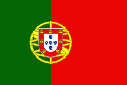
| Flag of Portugal | |
One of the oldest countries in Europe, its territory has been continuously settled, invaded and fought over since prehistoric times. The territory was first inhabited by pre-Roman and Celtic peoples who had contact with Phoenicians, ancient Greeks and Carthaginians. It was later ruled by the Romans, followed by the invasions of Germanic peoples and the Islamic invasion by the Moors, whose rule was eventually expelled during the Reconquista. Founded first as a county of the Kingdom of León in 868, gained its independence as the Kingdom of Portugal with the Treaty of Zamora in 1143.
Currency / Language
| ISO | Currency | Symbol | Significant figures |
|---|---|---|---|
| EUR | Euro | € | 2 |
| ISO | Language |
|---|---|
| PT | Portuguese language |


